This help facility provides information on the input options for each page. In addition definitions of certain terms are given in the Glossary
| SVSD | The SVSD interface gives easy access to the requested result without any advanced options. All possible grids are stored as profiles in the database |
| Default | The default interface is designed for advanced access to the grids. |
| Logging | The logging facility, here an overview is kept of the contents of the database. |
See also general points
| Size: | Match the image size by selecting one of the provided screen resolutions |
| Scale: | Select a storm scale or return to the default scale. Upon selecting one of them the grid will be reloaded. When a storm scale is selected, a different background colour is used to indicate that the storm scale is displayed. |
|
Parameter-groups: Pressure Waterlevel Wind |
Select the required parameter-group by clicking on the associated name. The main screen will refresh and contain the selected result (displayed in a graph) as well as the appropriate timetable. |
| Clone Window | Generate an identical window |
| 00.00 etc. (Time selection) | This timetable contains time steps from the three most recent available analyses for the selected grid only. At the top the date of the time step is shown. At the left the analysis time and date are shown. The coloured time indicates which time is currently displayed. New analyses will be shown as soon as they are loaded in the database. All changes that are made to the selection will effect all displayed graphs. |
| Geoselect | The interactive geographical selection will be enabled. |
| Region: | Choose a predefined area from the dropdown box. This will refresh the frame and show the grid with the given coordinates. |
See also general points
| 1) Source: | Select a data source. By selecting a source from the dropdown box the grid coordinates will be entered automatically. | ||||
| 2) Analysis time: | The analysis can be set to a specific time, ensuring that only data of the time steps from the chosen analysis will be available in the advanced selection. Select ‘most recent’ (if available) to select data from the history. | ||||
| 3) Geoselect:
| The geographical selection is a pre-selection. Upon selecting a source or after changing the coordinate system the range of coordinates for which data is available is displayed. Enter a set of coordinates for which the data is available. In the pre-selection either the coordinates can be entered or one of the predefined areas can be chosen. | ||||
| Area |
Select a predefined area for the grid. Only the predefined areas which are available in the currently selected coordinate system are shown. | ||||
| 4) Output: | Select the output type. There are two options:
|
||||
| This activates the above chosen settings and will produce output and more selection options on the right hand part of the screen. |
See also general points
| Variables | Which variables are available depends on the source of the data. For example the variables for Hirlam data are: Wind speed, Wind in u direction, Wind in v direction, Pressure. Variables can be shown using colour, contours or vectors on a map. The variable Colour is mandatory, the other two are optional. The number of variables that can be displayed as vectors on the graph is limited and the variable is mostly calculated from one or more other variables. |
| Plot | The first option is the time to select from the analysis or the recent history. The second option defines the grid layer to be plotted when using 3D grids. The last option defines the vector count. The vector count can be set for the X and Y axis. When zooming on curvilinear grids the vector count will automaticly be multiplied with the zoom factor. If this leads to an overflow of vectors, then the vector count will be set to the maximum grid count (ie. the amount of grid cells). |
| Scale: | The minimum and maximum values and the colours for the scale of the graph can be set here. The scale is set for the variable that defines the colour of the graph. The last option defines the contour scale. Each contour value is separated by a comma. To add more contour lines simply add numeric values. |
| Image | The image format can be set as PNG or GIF format in the third options row. The picture size can be set manually in any size larger then 400 pixels for best quality, smaller is possible but might show deformed results. |
| Clone Window | Generate an identical window |
| Interpolate | Interpolates a curvilinear grid to a rectangular grid after pressing the Submit button |
| Geoselect | The interactive geographical selection will be enabled. |
| Timeseries | Ticking the timeseries checkbox followed by selecting a location (using double click on the map) will generate a data output screen, useful for producing timeseries specific to one location (ie one set of coordinates). |
See also general points
| Fields | Shows all available variables from the selected source. Depending on the selected output format more than one variable can be selected. |
| Start | Starting time shown on output |
| Current | In case an analysis is selected only the time steps from the analysis will be displayed. When ‘Most recent’ is chosen as analysis, all collected times from the history will be available. To replay a scenario in the past a fictional current time can be selected, this will generate output of the fictional past time of the history data and the fictional future of an analysis. |
| Stop | End time shown on output |
| Timestep | In order to reduce the amount of data a timestep can be defined here. If interpolation is to be carried out this will take place after the reduction of the amount of data. |
| Stride X | In order to reduce the amount of data a stepsize in X direction can be defined here. Stride can only be used on a rectangular grid without interpolation. If a value of e.g. 5 is entered every fifth cell in X direction is used starting with 1 (thus 1, 6, 11, etc.) |
| Stride Y | In order to reduce the amount of data a stepsize in Y direction can be defined here. Stride can only be used on a rectangular grid without interpolation. If a value of e.g. 5 is entered every fifth cell in Y direction is used starting with 1 (thus 1, 6, 11, etc.) |
| Interpolate | Interpolates a curvilinear grid to a rectangular grid or reduces the number of grid cells by using the cell count or cell size defined by the user. |
| Cell count X | Set the grid cell count for the x-axis. This value will be used by the interpolation to reduce the grid to the specified number of grid cells. This number |
| Cell count Y | Set the grid cell count for the y-axis. This value will be used by the interpolation to reduce the grid to the specified number of grid cells. |
| Cell size X | Set the grid cell size in meters for the x-axis to reduce the number of grid cells. This value will be used to calculate the cell count X which in turn will be used for interpolation. The calculated cell count can be tweaked before submitting the result. (see Cell count X) |
| Cell size Y | Set the grid cell size in meters for the y-axis to reduce the number of grid cells. This value will be used to calculate the cell count Y which in turn will be used for interpolation. The calculated cell count can be tweaked before submitting the result. (see Cell count Y) |
| Format | Select the specific data output. When generating wind timeseries like Gnome or Dream 3 variables are mandatory: Wind speed, Wind in U direction and Wind in V direction |
| Clone window | Generate an identical window |
See also general points
| Recent data | Show sources overview. This is displayed when the logging page is selected |
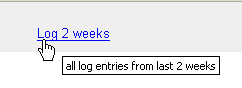
| Log 2 weeks | Display all log entries from the last two weeks |
| Log 3 weeks | Display all log entries from the last three weeks |
See also general points